Tutorial
How to use Mineral Truth
Nine quick steps — from typing in a legal description to reading ownership, wells, and the full chain of title. The orange boxes in each picture show you exactly where to click.
Watch the full walkthrough
Every feature in under four minutes — or scroll on for the step-by-step guide.
Start on the map, search a piece of land
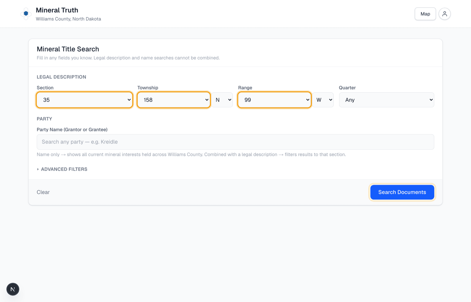
When you sign in, you land on the county map — every square is a section, every dot is a well, and the orange diamonds are new drilling permits. Click the "Search" button in the top-left corner, pick the Section, Township, and Range from the dropdowns (that's the legal description), and click the blue "Search Documents" button. One search pulls every courthouse document ever recorded for that section.
Tip: You can also just click any section right on the map — that runs the same title search instantly.
Results open right beside the map
The results panel slides in next to the map, so the land you searched stays in view — the section is shaded blue, and if it sits in a Bakken spacing unit the whole unit is highlighted with its full legal description and true surveyed acres in the header. The four boxes at the top give you the big picture in one glance: how many people and companies currently own minerals here, how much of the title is verified against the recorded chain, the active wells, and the oil produced over the last 12 months. Below them, two tabs organize everything: Ownership and Chain of Title. Need a report to keep or share? Click "Download Runsheet PDF".

Click any owner to see their ownership info
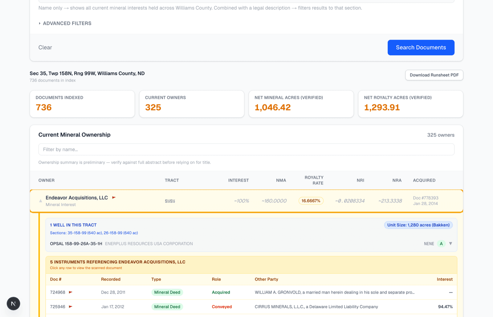
The Ownership tab lists every current owner in the section. Click any owner's row and it expands to show everything we know: the wells in their tract and the spacing unit size, and every recorded instrument that touches their interest — click an instrument row to view the scanned courthouse document itself. Solid black numbers are verified against the recorded chain; gray italic numbers with a ~ are honest estimates, shown when the county record alone can't prove the exact share.
Tip: Hundreds of owners is a lot to scroll — type a name in the "Filter by name..." box to jump straight to the owner you care about.
See who else is paid on the unit's wells
Wells here are drilled on spacing units that span multiple sections, and everyone in the unit appears on the division orders — even owners whose land is in a neighboring section. Click any section of a unit and the Ownership tab automatically folds in the owners from every member section, each tagged with their home section. If you've ever wondered why someone shows up on a check for a section they don't own minerals in, that's the answer.

Follow the chain of title
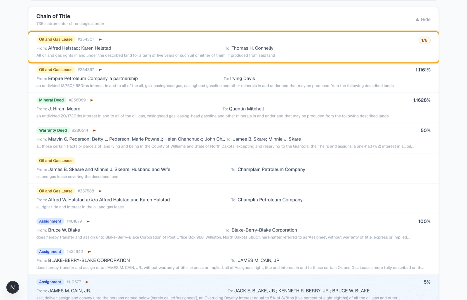
The Chain of Title tab opens on the tract's owners. Click any owner and their chain of title unfolds root-forward as a timeline — the documents that built that exact interest, with year markers, a colored dot for each instrument type, and the derivation math where the record computes it. Each row shows who conveyed to whom; click any row to view the actual scanned document behind it.
Tip: Want the old-school view? "All instruments" switches to the full chronological list of every recorded document in the section, with a filter box.
Click any well on the map
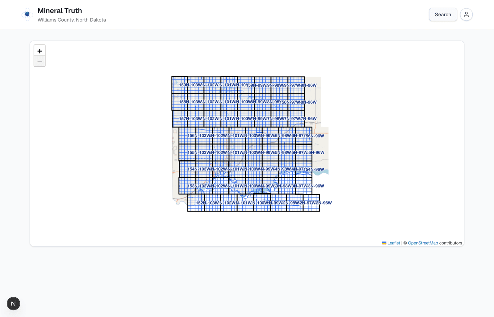
Every well in the county is drawn on the map, colored by status — green for active, orange for drilling, gray for inactive or plugged — and their laterals appear as you zoom in. Click a well and a panel opens with its operator, field, spud date, depth, and API number, its spacing unit with acreage and legal descriptions, cumulative oil and gas, and the full monthly production history as a decline curve. "View participants & owners" jumps to everyone paid on that well.
Tip: Know the well but not the land? Type its name or API number into the search panel's Well box — the map glides to it and opens this panel automatically.
Search by name instead
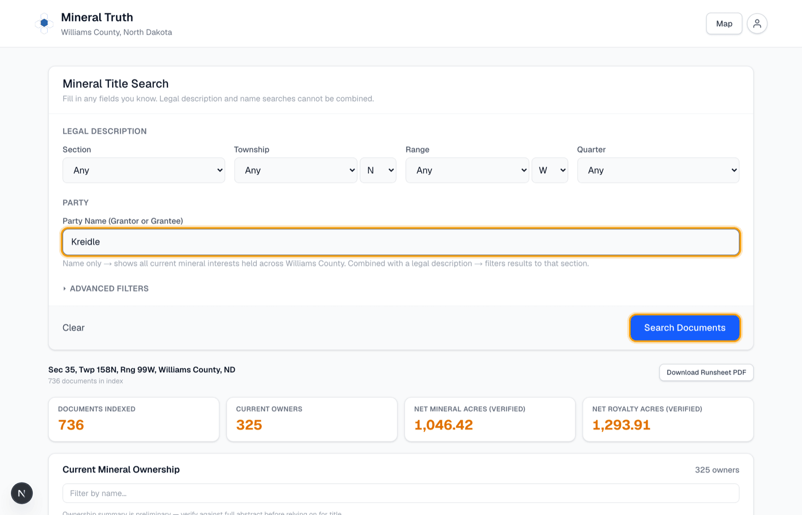
Don't know the legal description? Open the search panel, type a person or company name into the Party Name box, and click "Search Documents". Leave the land fields empty to search the whole county, or combine a name with a legal description to filter to one section.
See everything they own
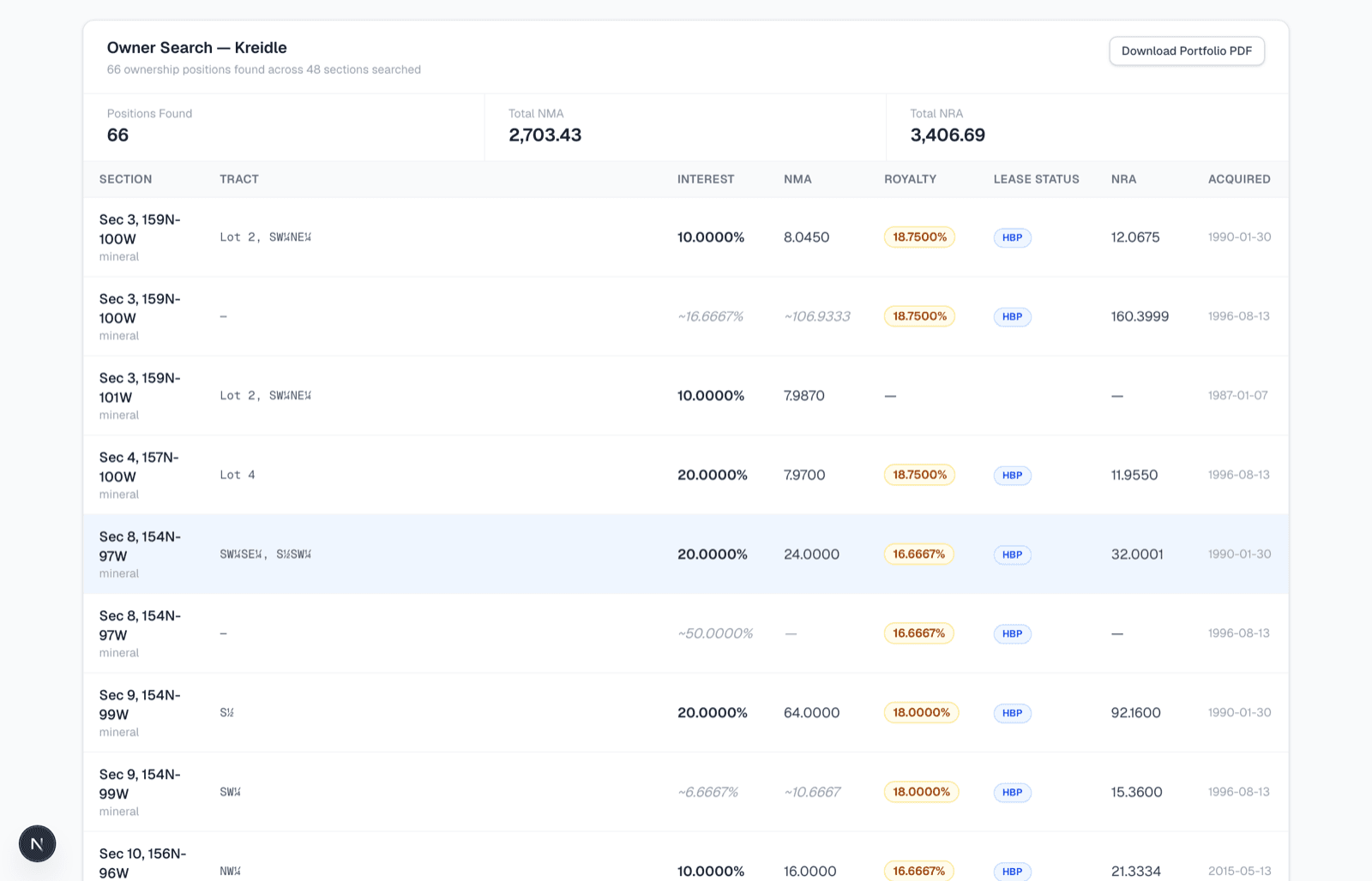
A name search returns every mineral position that owner holds across the whole county — section by section, with tract, interest, acres, royalty rate, and lease status for each — and lights up every section they hold in amber right on the map. Click any row to drill into that section, or click "Download Portfolio PDF" for a report of their entire portfolio.
Or just ask Derrick
Derrick is the built-in assistant in the bottom-right corner. Ask him how anything in the app works — "why are some numbers gray?" — or hand him the search itself: "who owns minerals in section 35-158-99?" and he runs it against the live record and answers with real owners and acreage. He's included on every plan; searches he runs count toward your monthly quota just like searches in the app.

That's all there is to it.
Pick a section or type a name, and Mineral Truth does the courthouse work for you. Ready to try it on your own land?